Trekking area
The hike was made across the territory of the Altai Republic.
The length of the route is 1500 km.
Duration - 3 days
Route scheme
The thread of the route
novosibirsk - Barnaul - Gorno-Altaysk - s. Inya - s. Inegen - r. Kakhnakhta - with. Inegen - s. Inya - Gorno-Altaysk - Barnaul - Novosibirsk
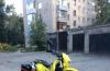
Participants and crews
Vehicle - VAZ 2115
|
FULL NAME. |
Team responsibilities |
|
|
Sitnikov Igor Viktorovich |
Manager, driver, mechanic |
|
|
Sitnikova Anna Mikhailovna |
Navigator, doctor |
|
|
Kleshchenok Mikhail Sergeevich |
Bicycle mechanic |
|
|
Minaeva Marina Alexandrovna |
Photo operator |
General information about the hiking area
Tungur-Inya trail
The Tungur-Inya trail, also known as the "Katunskaya trail", has been considered a classic of Russian motorcycle tourism for many years. Carved for tens of kilometers into the rock above the raging Katunya, the trail was used in Soviet times as a cattle-driving route from Mongolia. In some places, fortified cliffs and stone railings have been preserved.
After the Second World War, the captured Germans, under the leadership of a certain engineer, cut the so-called "dug road" at an altitude of about 300 meters above the river level in a 30-60-degree slope in order to connect the Chuisky tract and the Ust-Koksinsky district by road. However, the State Commission decided to shoot the engineer who was in charge of the construction site, since the "dug road", even immediately after construction, was too extreme for the movement of cars.
60 years have passed since then. The chopped shelves above the seething rapids of the Katun have collapsed in places, and the "dug road" has crumbled so that now it is only suitable for horses.
There were projects to make a highway out of the path, and they even managed to put it on car atlases. But these plans did not come true. Many visiting motorists coveted a "short" way from the Chuisky tract to Tungur, but in vain ...
Tungur is the starting point for most of the conquerors of Mount Belukha (4506m is the highest point of the Altai Mountains), from Tungur water routes start along the most difficult rapids of the Katunskaya pipe. The Tungur-Inya trail is considered a route of the highest category of difficulty for bicycle and motorcycle tourists. This route is well known and loved by tourists from all over Russia and Europe, and for good reason. These places are rightfully considered one of the most picturesque in Altai.
Route description
Day 0: preparation
Preparation for this train should be especially noted. The task requiring permission is as follows: there are 4 cyclists, naturally, with four bicycles and one VAZ 2115 car, it is required to deliver all cyclists 750 kilometers from Novosibirsk and return them back to the city in two days. It is difficult to imagine packing a car with such luggage, we are working on various options: we are trying to find another person with a car who, at our expense, would go to Altai for a couple of days, take part of the team, wait for us and return home. In this case, the problem of leaving our "tag" would also be solved, since if we go alone, we will have to leave the car in a rather disadvantaged area of \u200b\u200bAltai. Along the way, we are trying to solve the issue of a place where we can accommodate and which is as close as possible to the point of our starting point. A 100% suitable place for us is a sports complex on the Seminsky Pass, but a distance of almost 150 kilometers to the starting point, a fatal alignment for a cyclist, the arrival time at the starting point is almost a whole day - in this situation we definitely do not have time. If there is a second car, then the problem will be solved - some of the cyclists will be loaded into the car, and some could go in tow, with such a movement, these 150 kilometers would not take so much time and energy would remain saved. The second place is the village of Tungur, on the other side of the trail. But with this option, it is embarrassing that the distance to it is greater than to Ini, and the road is worse, plus to all this it is located in the border zone. That is, you need to either make the documents in advance for a pass to the border zone, or again lose it when registering on the spot, in any case, we will not have time to rest before the route, and this option, accordingly, disappears.
By the time we left Novosibirsk, we never found the second car. The only option is to load everyone into a car and go to talovo, that is, to the last more or less settlement, which is the village of Inya, and there already choose a place where it would be better to leave the car so that by our return it will remain safe and sound.
A few days before leaving, we train in loading the car: it is necessary that all things should be included, bicycles and four people! Naturally we disassemble bicycles and look for the most suitable places in the car for different parts of the bicycles. In principle, it seemed to work: four people and four bicycles in the car!
True, at the time of training, we damage two of the four bicycles: in one we break off the clip that holds the rooster, on the second it turns out that the chain is tangled, which after several hours of attempts we did not manage to unravel, and did not understand how it could turn over like this.
But we have time for troubleshooting. It's good that all this happens at home during preparation, and not upon arrival on the route almost a thousand kilometers from home. Taking into account the mistakes made, we repair damaged equipment, buy spare parts for bicycles, and at the next load we tie the chains to the frame to avoid tangling them.
We left Novosibirsk after a working day, at six in the evening. According to our plan, we had to pass the Tungur-Inya trail in one daylight, the plans are certainly ambitious, especially considering the fact that we have practically no experience in cycling travel. This is about a hundred kilometers - not a bad distance for a day's run, even for experienced cyclists.
According to our plan, we would arrive in the village of Inya at least by two o'clock in the morning in order to get some sleep before the cycling part of the route, and we had to start the route early, since the route was supposed to be very long and difficult. But as we were in no hurry, time was ahead of us, in the Ust-Sema area we were only after midnight, in Inya we arrived closer to dawn. Luckily for us, there was a hotel in the village where you can stay and leave your car under supervision. They went to bed only at four in the morning L.
The planned rise from six in the morning was postponed to eight, but in fact it turned out at nine, plus an hour to assemble the bicycles. In general, the time is already 10 o'clock, the sun is high, and we are still in Ina L.
We move for several kilometers along the federal highway, but now on bicycles, then we turn to the right and after a rather steep and prolonged descent we move to the other side of the Katun along the suspended bridge.
The road to Inegen runs along the coast of the Katun.
You will go to the right ... you will go to the left ... we go straight
Caution! Clean air inspires ...
After a steep and very long descent, along which it was very pleasant to roll down, but also not pleasant to climb up on the way back, he finds himself in the village of Inegen. Warned about the inhospitable attitude of the local population towards all kinds of tourists, the village is under way. Behind the village we replenish the supply of drinking water and go directly to the famous Tungur-Inya trail.
Apparently, having chosen the direction a little wrong, we find ourselves on the top of a huge mountain. Before us is an almost steep descent for tens, if not hundreds of meters down. A small river flows at the bottom, we are trying to determine from the maps what kind of river it is, because we must move along the mighty Katun. As it turns out later, we are so high up that from here the Katun seems to be just a small rivulet, of course the unique turquoise color of the water gives it away. We decide not to waste time returning back, and we begin a dangerous descent.
Not without falls:
Having gone down about half, the following view opens up, it becomes clear that it is Katun below us
Having realized this fact, we rejoice like children that now we can at least imagine where we are J
The trail goes right along the edge of the abyss
A little respite for a photo session ...
The bridge on the trail, built by Novosibirsk auto extremals Off Road Master in 2006 when passing this trail for the first time in cars.
However, he obeys Mishka, he is the only one of us who managed to call him.
The hoist exhausted us and at its top we have to make a small rest to recuperate.
We arrive in Yingu in the evening, buy groceries at a local store and go to our hotel to relax.
After yesterday's difficult day, we decided to sleep off and take our time to go home. We have a whole day ahead of us, so there's nowhere to rush.
On the way, we make a stop at Chika-taman.
From the very village of Inya, we are looking for a place where you could swim, before a good place was not far from Inya itself, in front of the Chike-Taman pass, where the Katun departs from the highway, but it was bought off by the next owners, pulling Altai apart in parts, the entrance is now on private property impossible, I had to go without refreshed beyond Ust-Sema.
Not everyone, or rather only Igor, decided to swim in the cold waters of the mountain Katun. Near Biysk, we make another stop at the former pits, on which the Turquoise Katun beach is now located, the place is not bad, clean, the water is clear, there are a lot of people, despite the fee for visiting this place, the close proximity of the city affects.
We stop by Misha's parents in Biysk, have a very tasty dinner, and by nightfall we get home without incident.
Tungur-Inya trail
The trail is a narrow path that runs along the bank of the Katun along a steep slope, in some places at an altitude of several hundred meters above the river. There are several difficult mountain passes along the trail, and it is also required to overcome several fords.
Equipment
The crew and vehicle were fully prepared for an autonomous existence for up to three days.
Vehicle preparation:
- Weaknesses and transmission parts are additionally protected
- The car is equipped with an extended set of necessary tools and spare parts to eliminate almost all possible cases of breakdowns
Crew training:
- Stock of food and water for cooking, including dry rations, for 3 days of autonomous stay
- Set of terrain maps and route legend
This was our first bike route outside Novosibirsk. Therefore, in this train, a lot of new experience was acquired regarding future cycling routes, this is loading a vehicle, and cycling equipment and new requirements for timing.
Unfortunately, the time on this trip somehow flew by with us at an incredible speed and drove by car much longer than planned, and on bicycles also did not fit into the schedule, so they did not take the entire planned route, although we hoped for it until the last. But, even taking into account our unfulfilled plans, I still liked the trip, and it's hard to even imagine how you might not like the time spent in the indescribable beauty of the Altai.
And the path will have to be finished next time J.
The night was cool and the morning sunny. They bathed in an oxbow with the clearest invigorating water, moved along it to the south, and by 9 am they entered Inegen.
It is a long, lively village, each courtyard has a hitching post, in some areas there are traditional Altai villages next to an ordinary hut. We still did not understand - this is more of a summer house for ourselves, relatives and guests - or the sprouts of the local folk tourism industry. They didn't guess to ask - but it would be worth it, for the future. By the way, about the infrastructure. On the floodplain near Inegen we came across freshly equipped parking lots, wide planed tables with benches and fireplaces. And in front of the entrance to the village there were several brand new huts, clearly built to receive tourists. And here, taking into account the water workers, there are not so few of them. But also a little - if you compare with the tourist mecca in the valleys of Akkem, Multa and Kucherla. So, for the entire route we met: a small cycling group from Ostashkov - on the first day, near the Chuiskaya arrow; a noisy team on the kata in the evening of the same day, on the second day another group of water workers came across, and another cycling group on the third. And this is all, not counting the two hunters (hunters for collectible samples of minerals) at Kaznakhta, and a couple of companies with cars and tents, already near Tungur. There were also a couple of local horsemen and two fishermen with a motorcycle - but that doesn't count.
Behind the village, the road goes up to a small saddle. At the bottom, about a dozen men are setting up a ferry - to transport cattle either to the right bank, or vice versa from there. The current in this place is strong - apparently, one of the cables has cut off.
There is a fork behind the saddle. Downward, crossing a deep ravine, a not too trodden path descends to the river; to the right - a well-worn road along the edge of the terrace to the Sok-Yaryk winter quarters. After some thought, we decide to follow the road.
We pass the burned-out winter hut, one or two more inhabited ones, wade the Sok-Yaryk stream, where we collect water and make a halt. From here, for a couple of kilometers along the terrace, the road goes along the slope, on which an overgrown and swollen groove of the road profile appears, traversing to the pass. Perhaps it was a dead-end branch to some adit, or they began to lead the path here, on top - and then they changed their minds and chose a rocky, but simpler option along the river bed with its terraces.
At the end of the terrace there is a fork again. Down, to the left and almost back - a modest track goes towards the river. Despite the seeming illogicality, this is the "regular" bend of the R-373, bypassing the rocky ridge and gently descending to the river. It seems to us that the road is more well-trodden and more logical - it goes up to a small saddle. View from the saddle to the right bank of the Katun
And this is a view back, you can see the road going towards the river - this is the true R-373
In the opposite direction - a view of the Katun valley and another fork
The rolled track turns to the right and goes up the sloping sai. We pass 200 meters along it, before we realize that we do not need to go there. We get down back to the fork and follow the left track. Soon it is lost, but at its end we catch a well-trodden rocky path leading in the right direction. It can be seen that in this place the bend of the R-373 is often cut, despite the extra height and strong slope. A breathtaking panorama of the river valley opens from the top of the trail. In this area, it was formed along a large deep fault. Opposite the arrow of Argut, a rock ledge and a section of the Path in front of it are visible - it is there that we will soon see magnificent outcrops of rocks characteristic of deep fault zones, with slip mirrors and other traces of collision of crustal blocks that were formed far from each other - but later brought together by powerful tectonic movements
We descend into the valley, enjoying the mesmerizing perspective of more and more new sections of the Trail
Hiking is not difficult here, but loaded cyclists are not to be envied - it is better for them not to meddle here, but return to the terrace and go around the bottom of the hill. According to the descriptions there is also a steep section - but small and conditionally passable. Here is an inferior shot from about the same point, but downstream: you can see a clear car trail coming from behind a bend - and you have to go along it
So, dropping about a hundred to one and a half meters in height, we come out to one of the most picturesque sections of the entire path - several kilometers The trail goes directly along the river bed. Imagine how three years ago four cars stormed this route ... In some areas I wanted to exclaim - heroes, in others - idiots! .. abnormal !! (we have not yet seen the murderous slopes beyond Kaznakhta!)
Along the trail, there are thickets of wild gooseberries - ripe, but small and bitter. And unsharp :)
Look at the right bank
Looking back
The water here is not yet turquoise (it will become higher than Argut, and higher than Akkem - and completely emerald), but resembles a shade of chrysoprase, green opal. As we approach the mouth of the Argut in the water, the difference in shades is more and more noticeable - turquoise-pearl under the left bank, opal-cacholong under the right
On the way to the mouth of the Argut, we look back again
At the beginning of an interesting section with rock ledges, cliffs, artificial fences, we meet two horse Altai
And this is the famous bridge over the crumbling section of the Trail. It can be seen that they managed to modernize it somewhat relative to the structure that Novosibirsk and Tomsk residents built during their heroic auto raid in 2006. Now, after the repair of the "failure", the trail is quite exploited by motorcyclists - we even met one. Perhaps local shepherds and fishermen are looking after this kind of "ovring". Or maybe the bridge has already been renovated by new brave motorists ??
The rocky ledge offers views of the picturesque Argut valley and Argut arrow. Separate sections of the Trail are fenced with stone masonry, which has collapsed in places. Here are some photos of this amazing place:
I do not know how many have heard of the existence of the Tungur - Inegen trail. I learned about her, of course, from the Internet. On some website the headline "Siberian Marathon 2006. Altai. Tungur breakthrough. Legendary first ascent" attracted attention. I can't say that I was particularly touched by the vicissitudes of this expedition (when I did not see this path in reality, you take this story somehow calmly). It just seemed interesting that there is a shortest "road" between the Chuysky tract and Mount Belukha. Just compare the length of this trail - 60 km, while the existing bypass road takes 500 km. Let's touch a little on the history of the origin of this path. Here's what information we managed to get again on the Internet.
The "Tungur Trail" emerged as a route for moving cattle from Mongolia to Russia in the 1920s. After the end of the Second World War, the construction of the Tungur-Inegen road began here. According to one information, the main labor force was German prisoners of war, according to another, more likely, our prisoners, who cut through the so-called "dug road" in a 60-degree slope. However, the task of connecting the Chuisky tract and the Ust-Koksinsky district of the Altai Republic by road was not fulfilled. The State Commission did not accept the road, considering it too dangerous for traffic, and engineers and designers were put on trial, some were even shot. In Soviet times, the road was even included in some car atlases, but it was never completed.
Returning one day from Aktru, we thought, why not turn around and see with our own eyes what kind of path this is.
If you go in the direction of Kosh-Agach, about 3 km after the village of Inya there is a bridge over the Katun, a wonderful such bridge.
Behind the bridge there is a road carved into the rock to Inegen. On one side, Mother Katun is running, on the other, there is a stone wall. You go in the car, it's scary, the edge is very close to the abyss. And got out of the car is not all that bad. The car seems like a bug.
A beautiful view of the Katun opens from the road. At the bottom of the Katun, a tourist center is located, the multi-colored roofs of ailchiks are clearly visible.
We didn't know exactly how to get to the path we needed, so we tried to follow the road signs in the atlas. First we got to the ferry. We realized that this was still not our direction and we didn't need to go to the opposite side of the Katun, we returned back, crossed the village of Inegen and drove onto some kind of country road. But since country roads in Gorny, apparently invisibly, then we dodged a little more until we found what we needed. The surest way is to stay close to the river.
It immediately became clear that you shouldn't even get in here in our car. The width of the road is normal at the beginning, but the height will not pass without damage. They did not become a hero, they found a convenient place to spend the night, and decided to explore the trail in more detail early in the morning.
There is not a soul around, silence. Katun in the rays of the setting sun is amazing, mysterious. And what else is needed for happiness.
We spent the evening by the fire talking and eating delicious borscht, which can be cooked exclusively over the fire. And in the morning we set off on foot.
Yes, it was not easy for the builders of this road. It was not just cut out in the rocks above Katun, but it was paved.
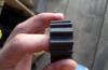
The place is very interesting, history is everywhere. For example, this is an incomprehensible unit for me.
The trail has long been chosen by bike and motorcycle tourists, as evidenced by the rock panel we met, unfortunately, did not take a photo.
Before the confluence of Argut and Katun, a part of the trail collapsed, but either jeepers or drivers of two-wheeled units erected a bridge here, thanks to which we were able to move on.
How long or short we walked and now we came out onto a green terrace, even if you play golf or play football. Katun remained to the side below.
The Kaznakhta rivulet murmurs, in a hurry; its transparent waters sparkle in the sun, shimmer. Krasotischaaa !!!
Kaznakhta went over the logs. After Kaznakhta, the landscape changes, we find ourselves in a mixed forest with a predominance of birches.
On the way again a reminder of the past.
After walking a little more, we decided to turn back in order to return to the car before dark.
It's a pity, of course, I was very interested to see the confluence of Akkem and Katun, to see the place where the village of Akkem used to be, which in the early 20th century had 15 courtyards and had a small church. It is hard to imagine that wheat and oats were once planted here on mountain terraces.
From the guidebook, Alexandra Lebedeva learned that this village has a rich history. It was here in 1921 that the detachment of Alexander Pavlovich Kaigorodov, the leader of the Altai rebels during the Civil War, was based. In addition, the famous Altai storyteller Saldabay Savdin lived here, from whom ethnographers wrote down the text of the heroic legend "Kan-Altyn".
But back to my story. We decided to return back by a slightly different route - along the Katun river.
To Kaznakhta we walked along coastal boulders, or rather jumped from one to another. The Kaznakhta was forced in the same manner. And I almost plopped my heel into the water, sliding off a large boulder. We saw how the clear waters of Kaznakhta mix with the turquoise of the Katun.
Soon tired of jumping, it's time to get out on a normal road.
We climbed a rather steep slope and found ourselves in the already familiar high glade.
Beautiful places are still here.
The walk along the Inegen-Tungur trail along the turquoise Katun (this is where the turquoise Katun is) turned out to be very entertaining, here you will find the history and beauty of Gorny Altai. My legs were buzzing with today's exercise. But after the water procedures in Katun, fatigue vanished as if by hand. All of our team members fussed about preparing dinner. And again, a soulful evening by the fire under the starry Altai sky and the music of the rushing waters of the Katun.
Let's introduce ourselves! My name is Nikolay, I live in Barnaul, I own a Suzuki DR-Z400S motorcycle born in 2002.
http: //
This is my first motorcycle, and after one year of riding around the area, thoughts of traveling somewhere further away from the nearest forest began to endlessly creep into my head. I chose the route all winter, mainly focusing on the existing fresh reports on various motorcycle resources. Many dissuaded, referring to the lack of experience and other factors, I myself was afraid of three things: to drown the mot, get lost, and some serious breakdown, in principle of any breakdown. I'm a humanist)). I wanted to find fellow travelers, but it didn't work out. As a result, I doubted whether to go or not until the last day, the jitters were strong, and I am glad that the spirit of adventurism conquered all my fears! It was decided to go in early August, there was no exact date, both departure and arrival, but it was thought that a maximum of two weeks, in the end I was only enough for six days! :-) six, but what kind !!! Route: Barnaul, Inya-tyungur, multinsky lakes, Barnaul. Go!
http: // 
Day one (second of August)
On the first day I wanted to get to Ini, and spend the night there not far from the confluence of the Chuya and Katun. The distance of about 400 km is serious for me, I had to overcome two passes, which I did not know on a motorcycle, it was decided to leave at four in the morning, so that there was a margin of time, and all the beauty to see during the day.
I wake up, from excitement I can hardly stuff a bun into myself, and I dress in the garage. I pack the remaining things in the hermabaul and ... down with all doubts, fear of not luck, the frosty morning air makes you understand that the decision has been made, and now only forward! My first line was the checkpoint of the gai, since I did not have numbers and the mot accounting and this milestone is passed, with each km traveled it becomes morally easier and the excitement completely disappears. Driving along the highway, chilly, after a while I stop and put on my jacket. The average speed is 120-130, the bike runs easily, I meet a cloudy sunrise, and ... After about 100 km the bike stalls. It turned out that gasoline simply ran out. I took with me two cans of 10 liters each, and in order not to constantly remove them, I decanted gasoline into a bottle, and then poured it into the tank, this procedure took only a couple of minutes. In order not to stop every hundred kilometers, I decided to keep the average speed of about 100 and turned the gas crane into reserve. my main reserve was in cans. I decided not to stop in Srostki. Expensive of good quality, but closer to the border with the Altai mountains, it becomes almost ideal, and so the entire Chuysky tract. There are no problems with gas stations, but sometimes the AI-95 is missing.
http: // 
Pass Seminsky highest pass on the Chuysky tract. The height of the pass is 1717 m, the ascent is 9 km, the descent is 11 km, it crosses the Seminsky ridge between the Sarlyk mountains and the Tiyakhty Summit, the border of the Northern and Central Altai. Climbing steepness, the small bike ran easily in 4-5 gears.
http: // 
In 1956, a stele was erected at the top of the pass in honor of the bicentennial of the voluntary entry of the Altai people into Russia. From this place one can see the Sarlyk mountains and the Tiyakhty peak. Also, souvenir shops and all the benefits of civilization, there are many bases in the vicinity, a fairly popular place. Having dined on whitewash without meat and chocolate, I drove on))
Oddly enough, at the more famous gas stations, AI 95 was absent, and at the "local" gas station sometimes was, what kind of attack I do not know ...
http: // 
Chike-Taman pass
http: // 
The Chike-Taman pass is much more interesting, the ascents are steeper, the view is more picturesque. I ran it already in 3-4 gear, a couple of times I stuck the second one. At the top, as in Siminsky, there are tents with souvenirs for tourists, there is also an observation deck, you can walk, but you can also take a motorcycle, which is exactly what I did.
http: // 
This is me, happy
http: // 
This is the road to the observation deck of the pass, and the path that goes to the left, the remains of the old Chuisky tract, I learned from a conversation with a local souvenir seller.
http: // 
The road continued to delight with its views and asphalt, the weather was excellent. Even such a quality of the road began to strain, because I'm still on enduro, oh, if only I knew what was ahead of me, and how I would dream about this asphalt in five days.
My next main point was actually to find this famous trail Inya-Tungur. Since I knew that the bridge from the highway was washed out and not restored, my arrival on it had to take place before Ini, I had Mega landmarks, Nika's gas station, and a bridge across the Katun, which did not need to be crossed.
Blurred bridge
http: // 
In general, having wandered a little, I did not find where I had to go and moved on, because I have a rare disease, which some call "topographic cretenism", in fact it is true)). I had a car navigator with me, an iPad with an offline map, a compass and a tourist map of the Altai Republic! Yes, I was reinsured! But even that did not help))) the navigator refused to catch satellites and the iPad showed that I was still somewhere near Ongudai. Mystic. I still have no explanation for this. Remembering the saying "the language will bring to Kiev" I went to look for the locals, but faced a problem, the Altaians themselves, in the area of \u200b\u200bthe village of Inya, spoke Russian very poorly, an elderly man with whom I had a chance to communicate, showed me the direction of the approximate distance and something else, it was extremely difficult for me to understand him)). In general, I realized that somewhere not far away there are two bridges that I did not know about and which were not on any map. One of which is through the feel, the other, respectively, through the Katun. He explained this to me literally on his fingers, it was no longer convenient to ask again for the hundredth time, and realizing that I squeezed out of him everything I could, he went to look for these two bridges ...
http: // 
Arriving at the observation deck of the confluence of these two rivers, I saw a souvenir shop in the form of a yurt, there was a girl who, oddly enough, also spoke Russian poorly and was only able to show me the direction. road And lo and behold, I see a construction site and a huge metal bridge with prohibition signs from all sides, they say entry is prohibited
Bridge across the Katun
http: // 
Two new bridges
http: // 
That little triangle on the left is the campsite where I wanted to spend the night on the first day. But all my navigators did not work and I went ahead, because It was terribly interesting what was next, an easy off-road began, and the fact that I literally groped this path was my little victory, which inspired me a lot!
http: // 
| Category: REPORTS | Added: (08.02.2016) | |